

Final Update: September 3, 2026 at 9:10 AM
Edouard Dissipates, Flood Watch Continues for Walker County
The former tropical storm is no longer a tropical depression, but periods of heavy rain remain possible Thursday.
Edouard has weakened into a remnant low over North Texas, ending its time as a tropical cyclone. The National Hurricane Center and Weather Prediction Center issued their final public advisory on the system at 4 a.m. Thursday.
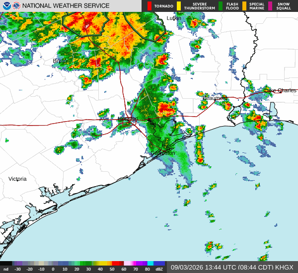
At that time, Edouard’s remnants were about 40 miles southeast of Dallas, moving west-northwest at 5 mph with maximum sustained winds of 25 mph. The system is expected to continue weakening and dissipate.
Implications for Huntsville and Walker County
The primary remaining concern for Huntsville and Walker County is locally heavy rainfall, not tropical-storm-force winds.
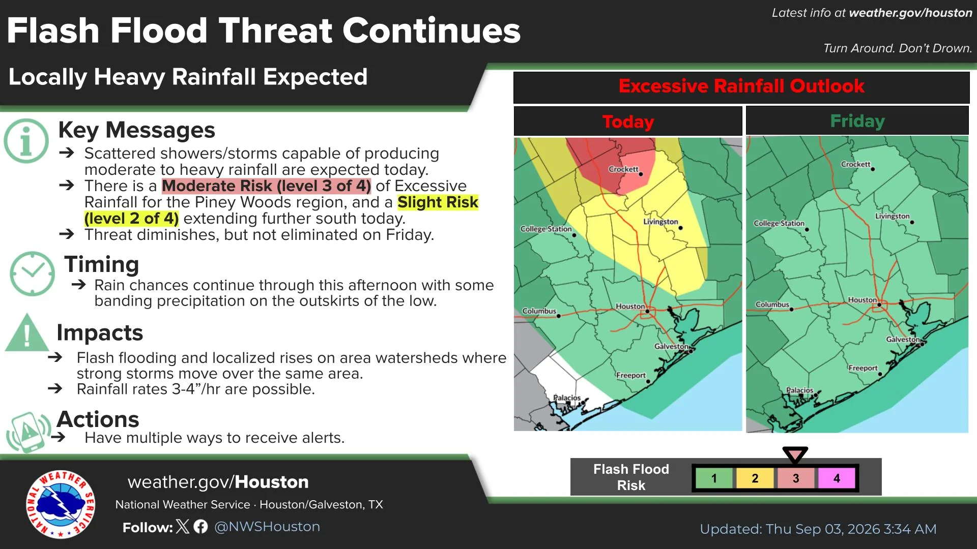
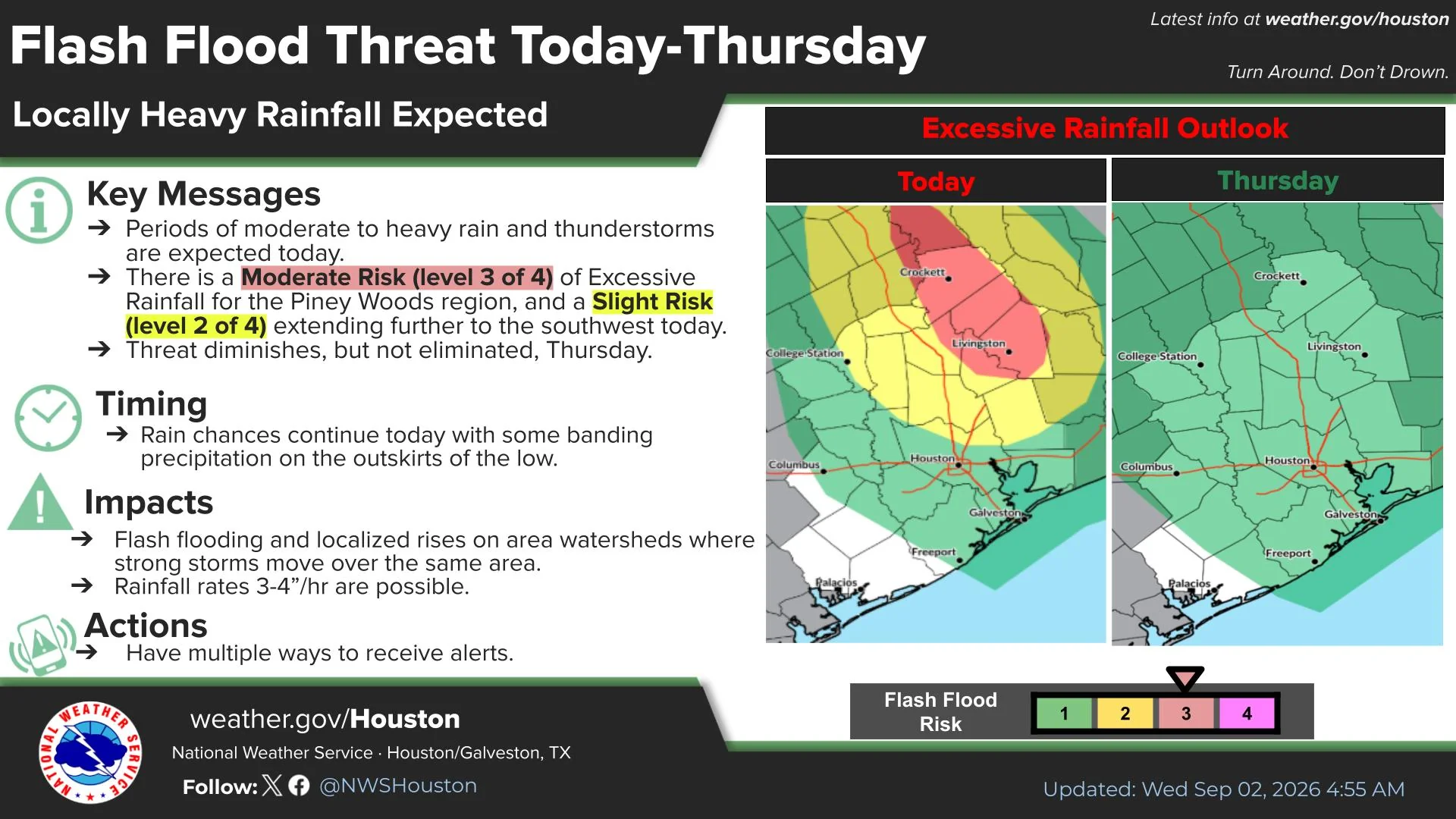
Walker County remains under a Flood Watch until 1 p.m. Thursday. The National Weather Service said showers and thunderstorms associated with Edouard’s remnants could produce heavy rainfall over short periods. Excessive runoff could cause flooding along creeks, streams, low-lying roads and areas with poor drainage.
The Huntsville forecast calls for a 50% chance of showers and thunderstorms Thursday, with generally one-quarter to one-half inch of additional rainfall possible. Locally higher amounts could occur beneath heavier storms.
Residents should continue monitoring conditions and avoid driving across flooded roads. No tropical storm warning is in effect for Walker County.
This will be Hello Huntsville’s final scheduled update on Edouard unless additional flooding or severe weather affects the area.
Last Updated: September 2, 2026 - 10:00 AM
As of 10 a.m. Wednesday, Edouard has weakened to a tropical depression with maximum sustained winds near 35 mph. The center of circulation is tracking north through East Texas, east of Huntsville and most of Walker County. That places much of the county west of the storm’s center, reducing the threat from its strongest winds, but periods of heavy rain and gusty winds remain possible. National Hurricane Center
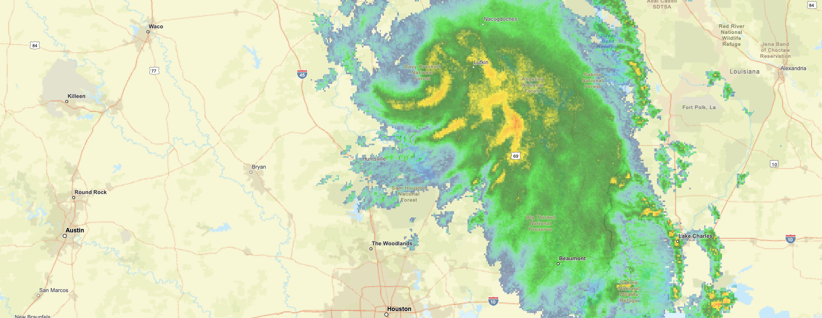
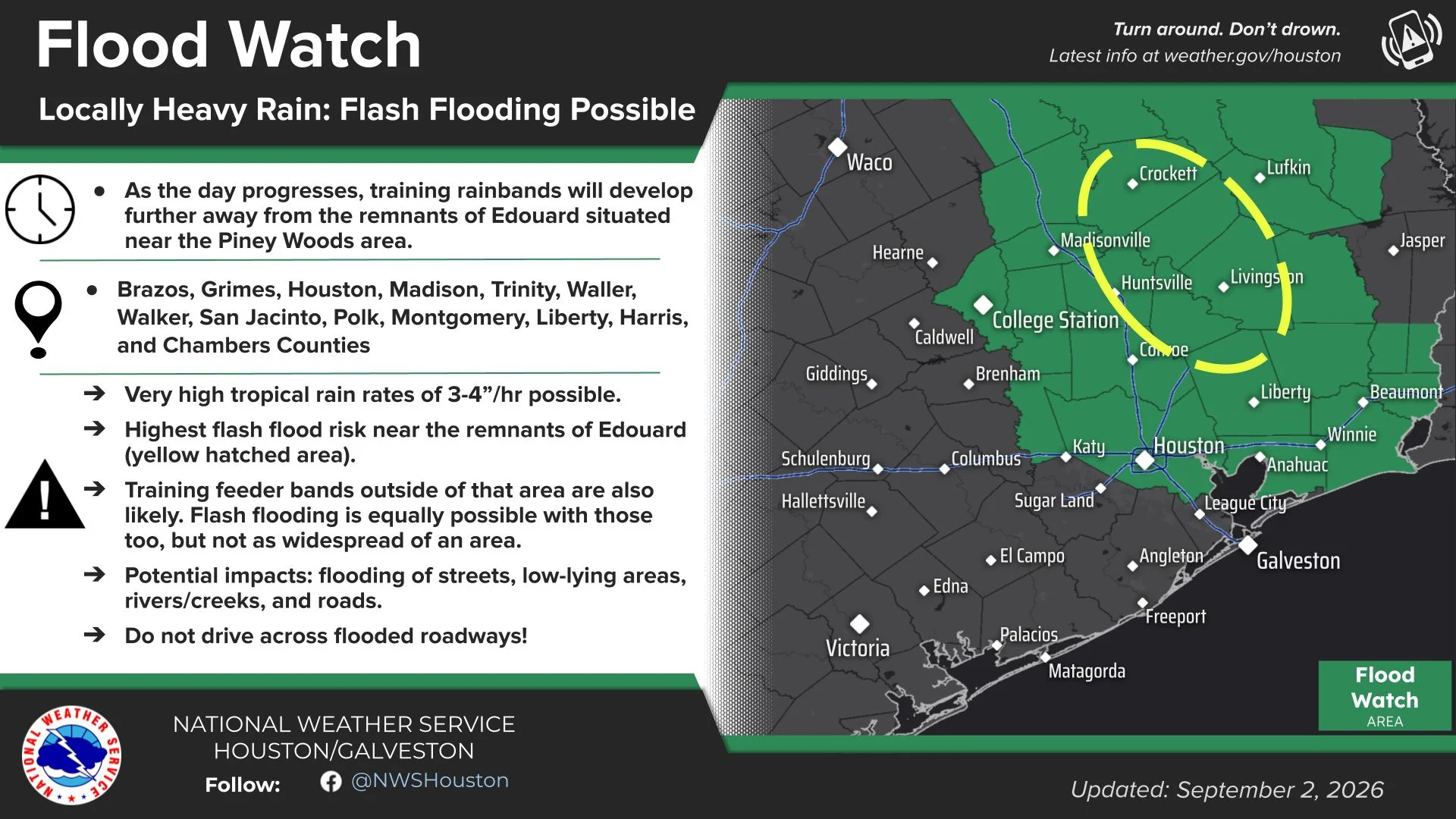
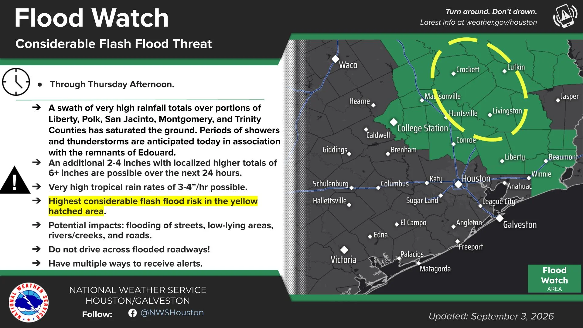
The National Weather Service extended the Flood Watch for Walker County through 7 a.m. Thursday, warning that additional heavy rainfall could cause flash flooding in low-lying, flood-prone and poor-drainage areas. A Wind Advisory remains in effect until 1 p.m. Wednesday, with winds of 15 to 25 mph and gusts of 35 to 45 mph possible. As of 10 a.m., no Flash Flood Warning, Tornado Warning or Tropical Storm Warning was listed for Walker County. National Weather Service Houston/Galveston
Last Updated: September 1, 2026 - 8:30 PM
Flood Watch and Wind Advisory Remain in Effect for Walker County
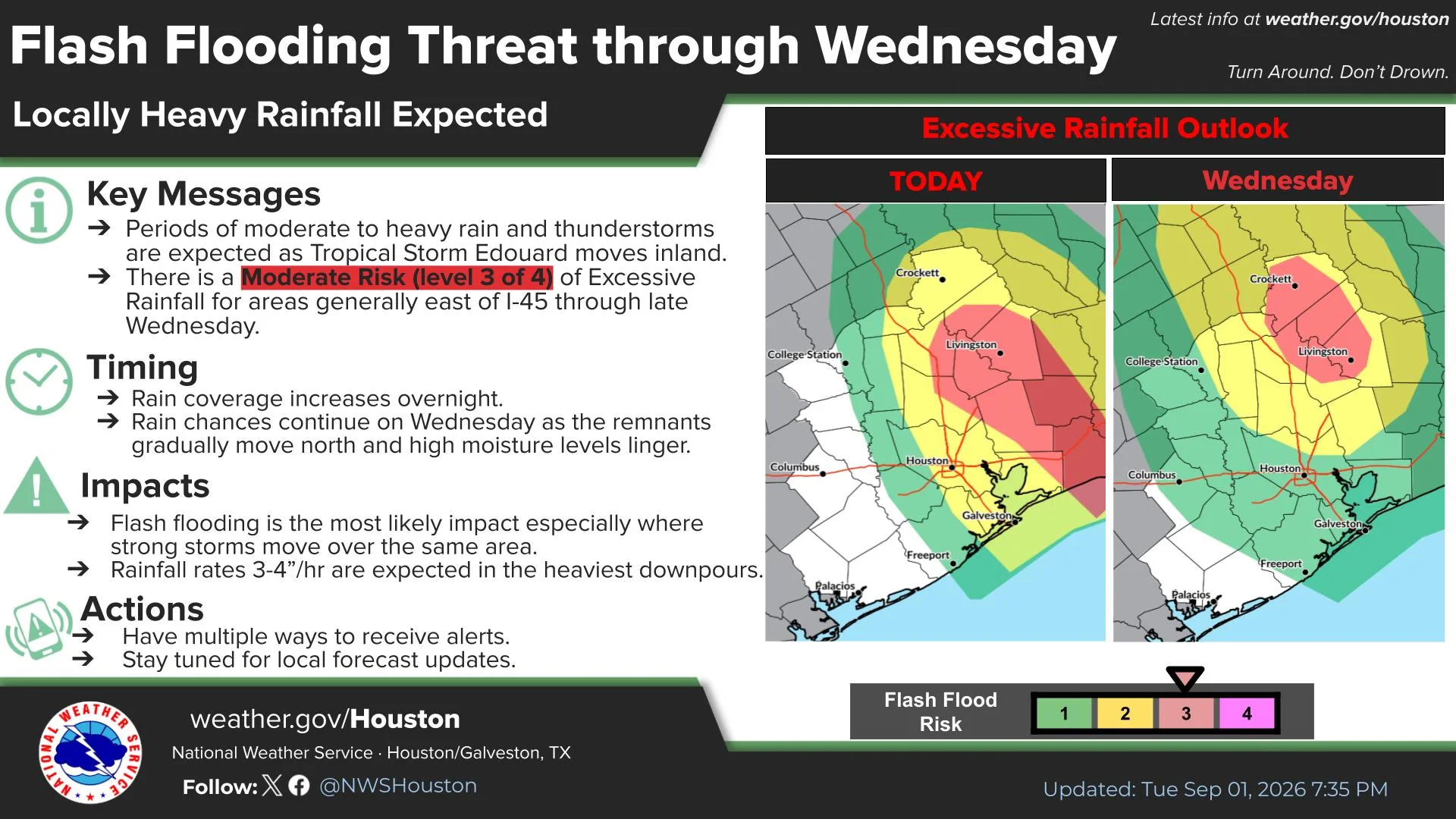
The National Weather Service has continued a Flood Watch for Walker County, including Huntsville, through Wednesday evening as Tropical Storm Edouard brings the threat of heavy rainfall and potentially dangerous flash flooding to Southeast Texas.
Forecasters expect widespread rainfall totals of 3 to 6 inches, with isolated amounts of 10 to 15 inches possible. The highest totals are expected along and east of Interstate 45. Rainfall rates could reach 3 to 4 inches per hour during the heaviest downpours.
The National Weather Service says flash flooding is likely, with considerable flash flooding possible. Excessive runoff could flood creeks, streams, low-lying areas, poorly drained locations and roadways.
A Wind Advisory also remains in effect for Walker County until 1 p.m. Wednesday. East to northeast winds of 20 to 25 mph are expected, with gusts reaching 35 to 40 mph.
The gusty winds could blow around unsecured objects, bring down tree limbs and cause isolated power outages. Driving may also become difficult, particularly for high-profile vehicles.
Residents should continue monitoring official forecasts and be prepared to act if a Flash Flood Warning is issued. Those living in flood-prone areas should remain especially alert overnight.
Never drive or walk onto a flooded roadway. Water may be deeper or moving faster than it appears.
Last Updated: September 1, 2026 - 1:00 PM
Tropical Storm Edouard Strengthens Near Texas-Louisiana Coast; Walker County Under Flood Watch
This report reflects the National Hurricane Center’s 10 a.m. CDT advisory and the National Weather Service flood watch issued at 9:51 a.m. Tuesday, Sept. 1.
Tropical Depression Five strengthened into Tropical Storm Edouard at 7 p.m. CDT Monday, according to the National Hurricane Center. At that time, maximum sustained winds had increased to 40 mph.
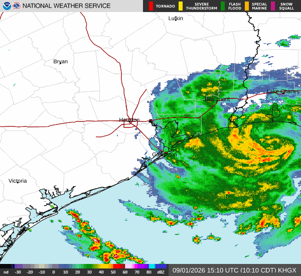
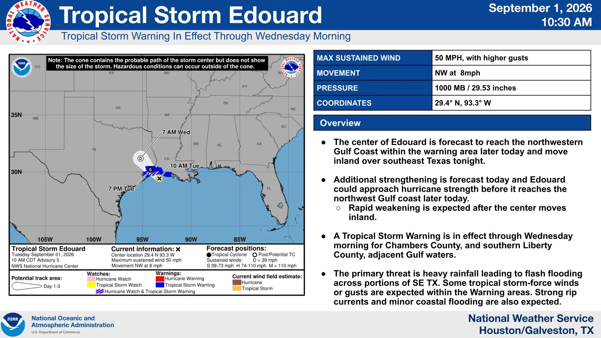
As of 10 a.m. Tuesday, Edouard was located about 50 miles southeast of Port Arthur and 30 miles south of Cameron, Louisiana. Maximum sustained winds had increased to 50 mph, with higher gusts. The storm was moving northwest at 8 mph with a minimum central pressure of 1,000 millibars.
Additional strengthening is expected before Edouard reaches the northwestern Gulf Coast later Tuesday. The National Hurricane Center said the storm could approach hurricane strength before landfall near the Texas-Louisiana border. Rapid weakening is expected after the center moves inland across Southeast Texas Tuesday night.
Edouard is a small tropical cyclone, with tropical-storm-force winds extending approximately 25 miles from its center.
Impacts along the Texas coast
A Tropical Storm Warning is in effect from Port Bolivar, Texas, to the Vermilion-Iberia Parish line in Louisiana. A Hurricane Watch remains in effect from High Island to Cameron, Louisiana.
The National Weather Service Houston/Galveston office has placed Chambers County, southern Liberty County and the Bolivar Peninsula under a Tropical Storm Warning. Inland winds of 20 to 30 mph, with gusts reaching approximately 40 mph, are possible in the warned areas, especially within stronger rainbands.
A Storm Surge Warning is also in effect from High Island to the Vermilion-Cameron Parish line. Water could rise 3 to 5 feet above ground level along portions of the immediate coastline. The deepest water is expected near and east of Edouard’s center.
The National Hurricane Center said a tornado or two could develop Tuesday afternoon or evening across portions of Southeast Texas and southwestern Louisiana.
Walker County forecast
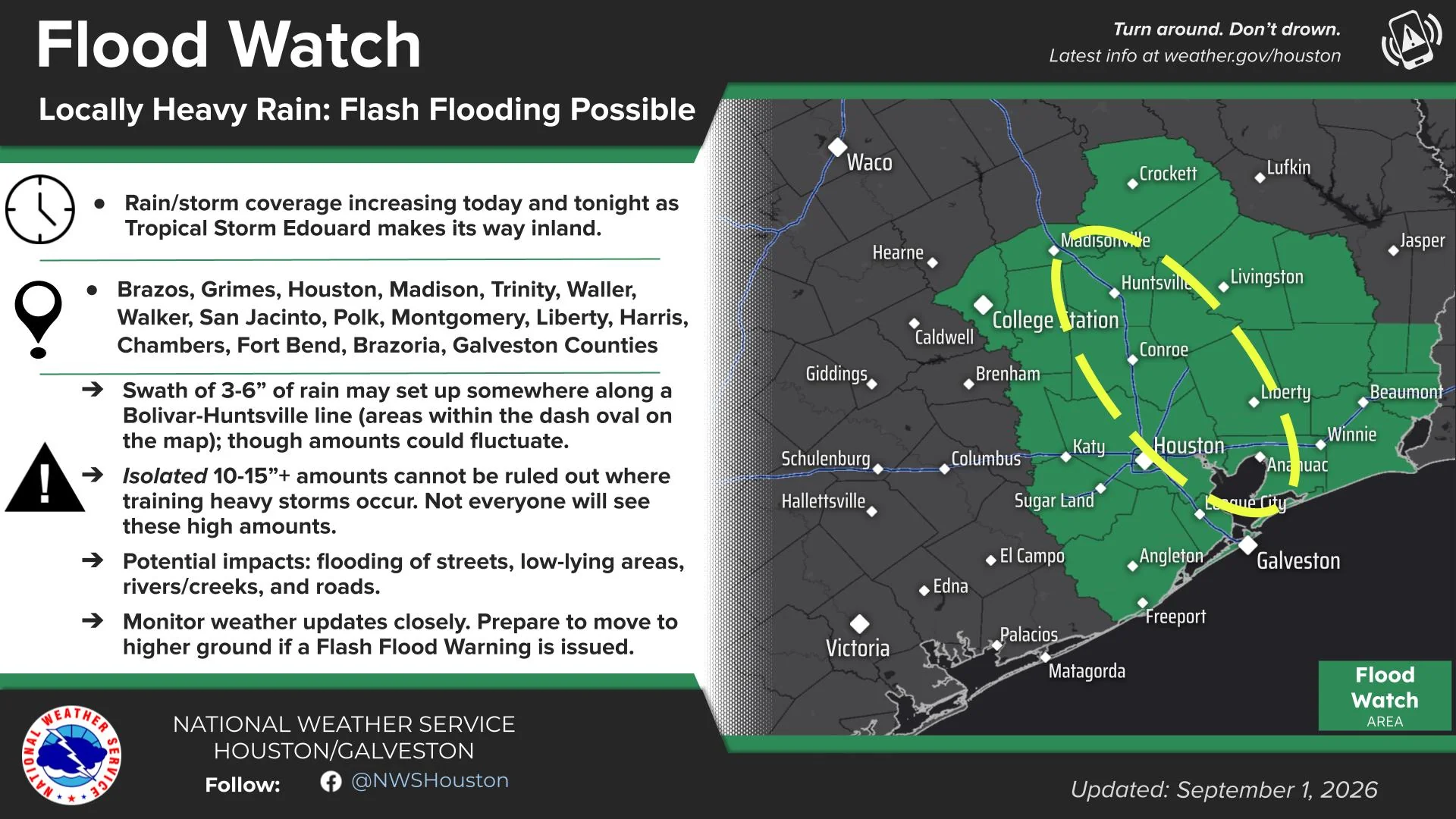
Walker County is now included in a Flood Watch through 7 p.m. Wednesday. Walker County is not currently under a Tropical Storm Warning.
The National Weather Service said periods of moderate to heavy rain could begin Tuesday afternoon and become more widespread Tuesday night and Wednesday.
The current Huntsville forecast calls for:
- A 60% chance of showers and thunderstorms Tuesday afternoon.
- An 80% chance Tuesday night.
- A 90% chance Wednesday.
- North to northeast winds of 5 to 15 mph Tuesday and Tuesday night.
- Wind gusts possibly reaching 25 mph Wednesday.
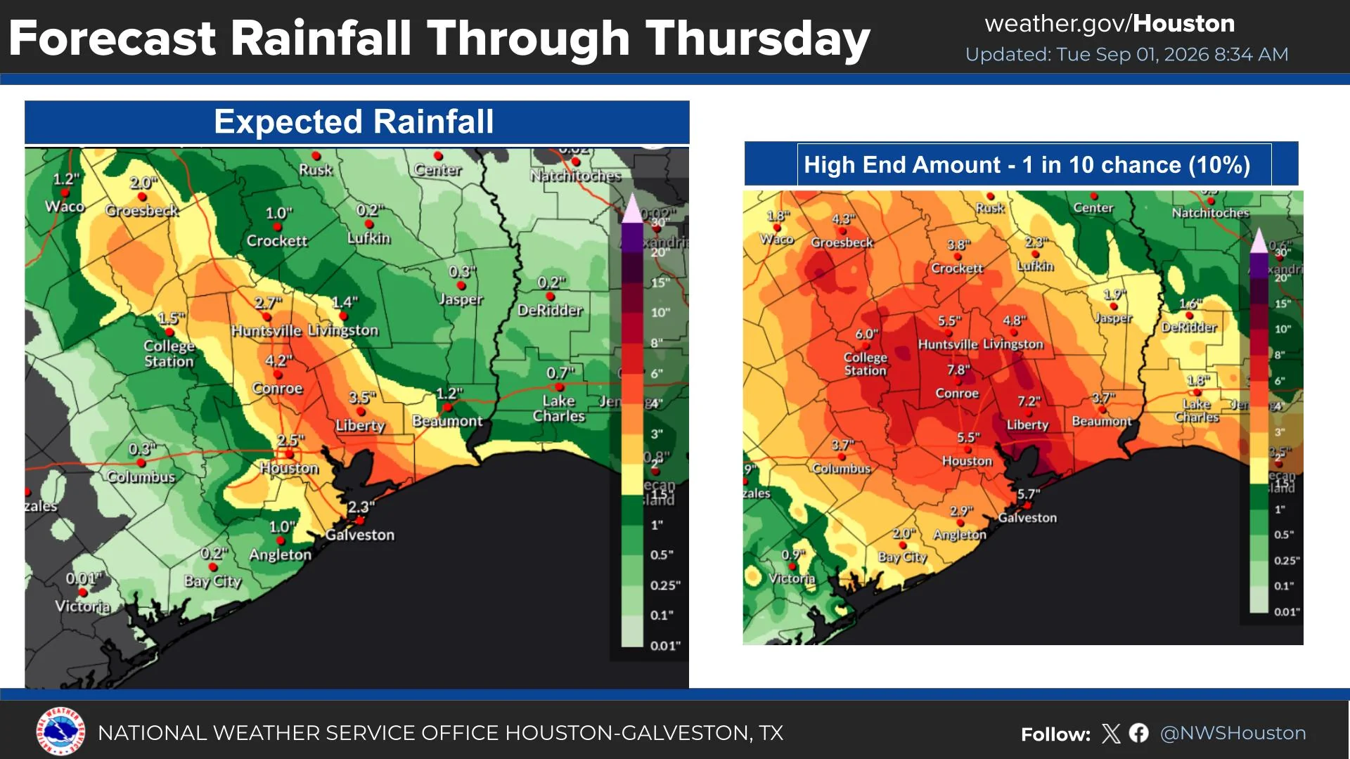
Across the flood-watch area, including Walker County, the National Weather Service forecasts 3 to 6 inches of rain, with isolated totals of 10 to 15 inches possible. The greatest totals are expected along and east of Interstate 45. Rainfall rates could reach 3 to 4 inches per hour beneath the strongest rainbands.
Not every location will receive the highest amounts. The placement of the heaviest rainfall will depend on Edouard’s exact track and where persistent rainbands develop.
The National Hurricane Center’s broader forecast calls for 3 to 6 inches of rain, with maximum totals near 9 inches, from the Upper Texas Coast into east-central Texas.
Primary concern for Walker County
Heavy rainfall and localized flooding are the primary concerns for Walker County. Excessive runoff could flood roads, creeks, low-lying locations and areas with poor drainage. The heaviest period is currently expected from Tuesday evening through Wednesday, although rain may continue into Wednesday night.
Residents should monitor updated forecasts and never drive onto a flooded roadway.
Official information: National Hurricane Center advisory archive, NWS Houston/Galveston and Huntsville point forecast.
Last updated: Aug. 31, 2026
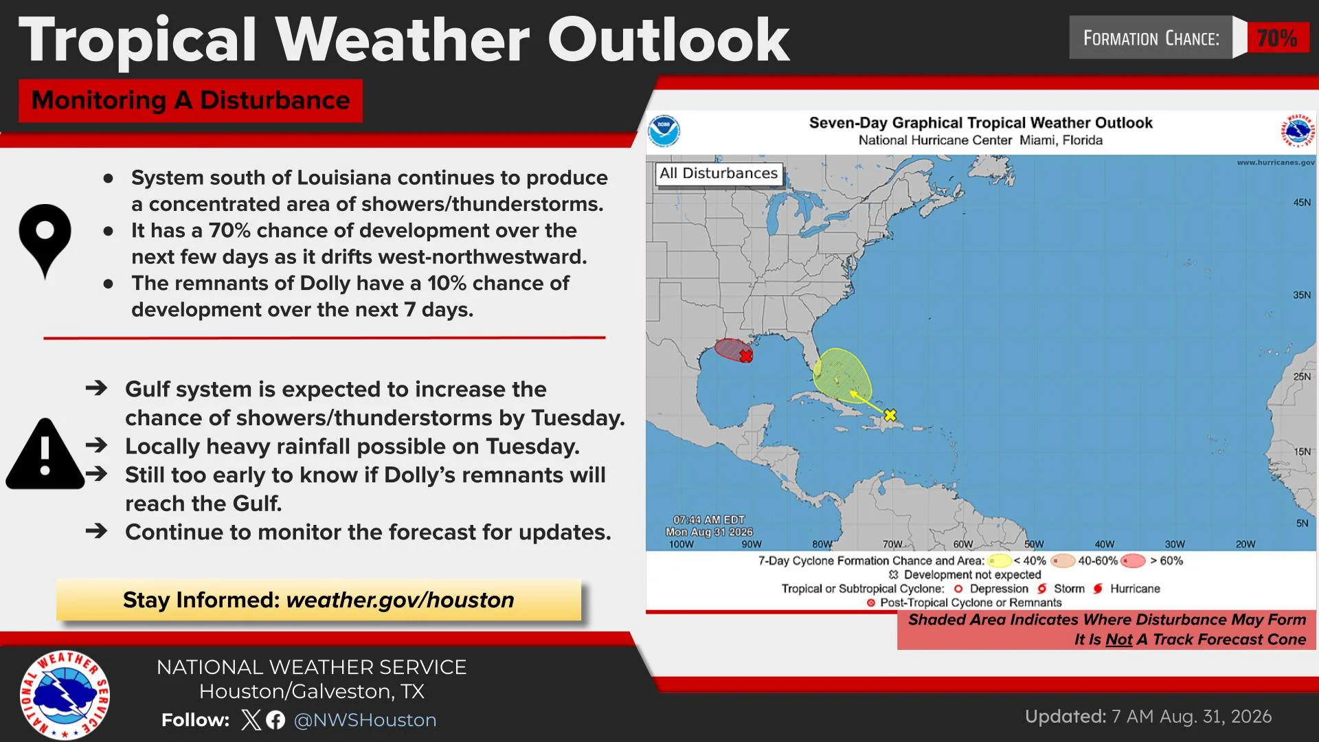
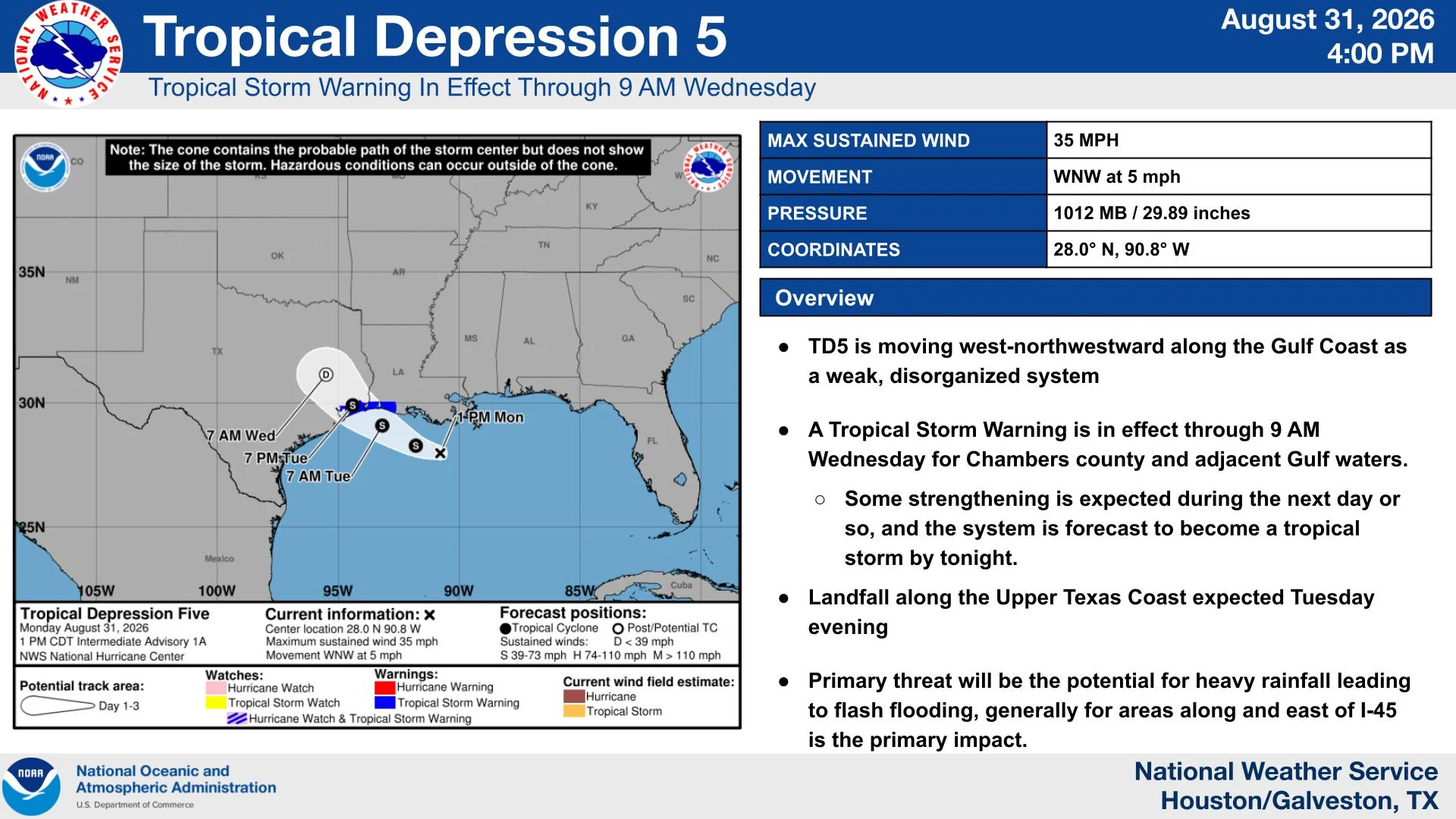
HUNTSVILLE, Texas — Walker County could receive several inches of rain Tuesday and Wednesday as Tropical Depression Five approaches the upper Texas and southwestern Louisiana coast.
The system was moving west-northwest across the northern Gulf of Mexico on Monday afternoon. Forecasters said it could strengthen into a tropical storm before reaching the coast Tuesday.
The National Weather Service expects rain chances in Walker County to increase to 50% Tuesday afternoon and 70% Tuesday night and Wednesday.
How much rain could Walker County receive?
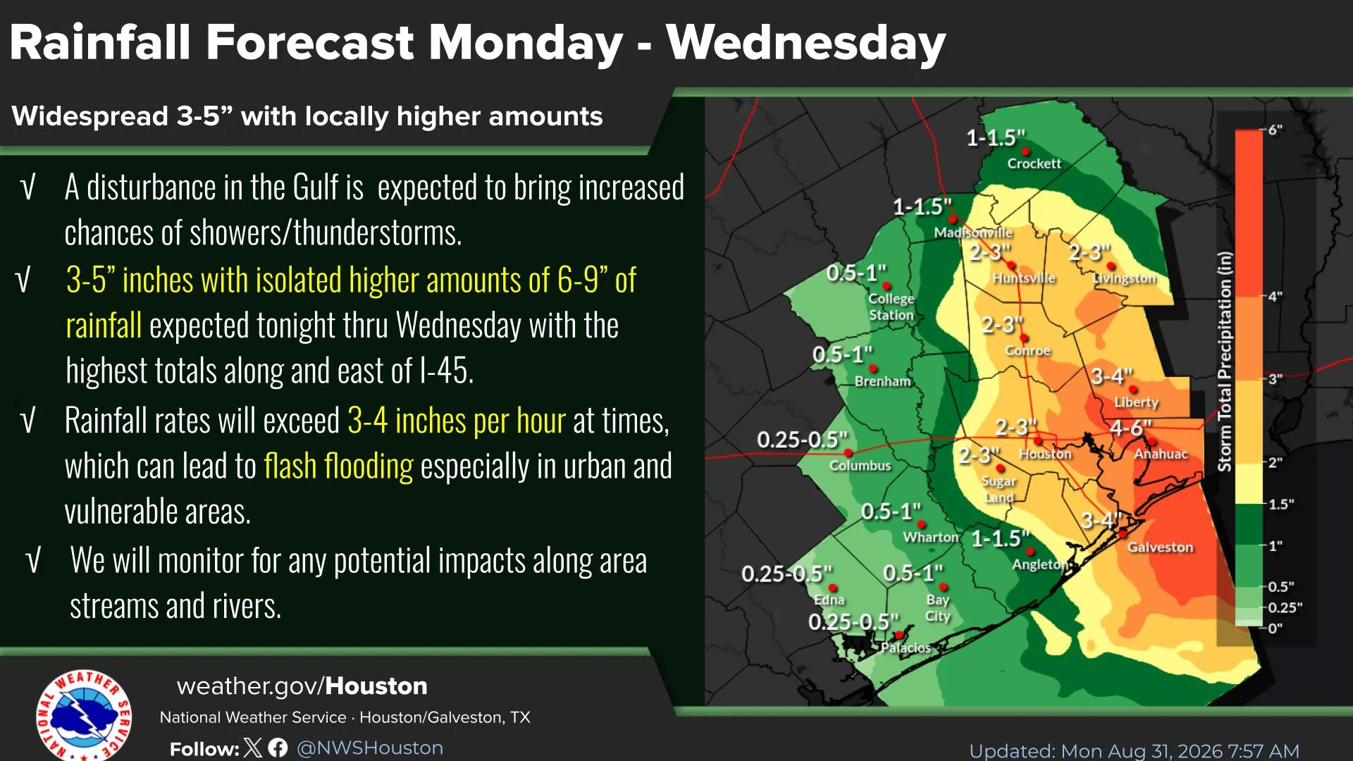
The National Weather Service forecasts widespread rainfall totals of 3 to 5 inches across Southeast Texas, with isolated amounts of 6 to 9 inches possible, especially east of Interstate 45.
Those amounts cover a large portion of the region and do not mean every location will receive that much rain. Totals in Walker County will depend on the storm’s track and where the heaviest rain bands develop.
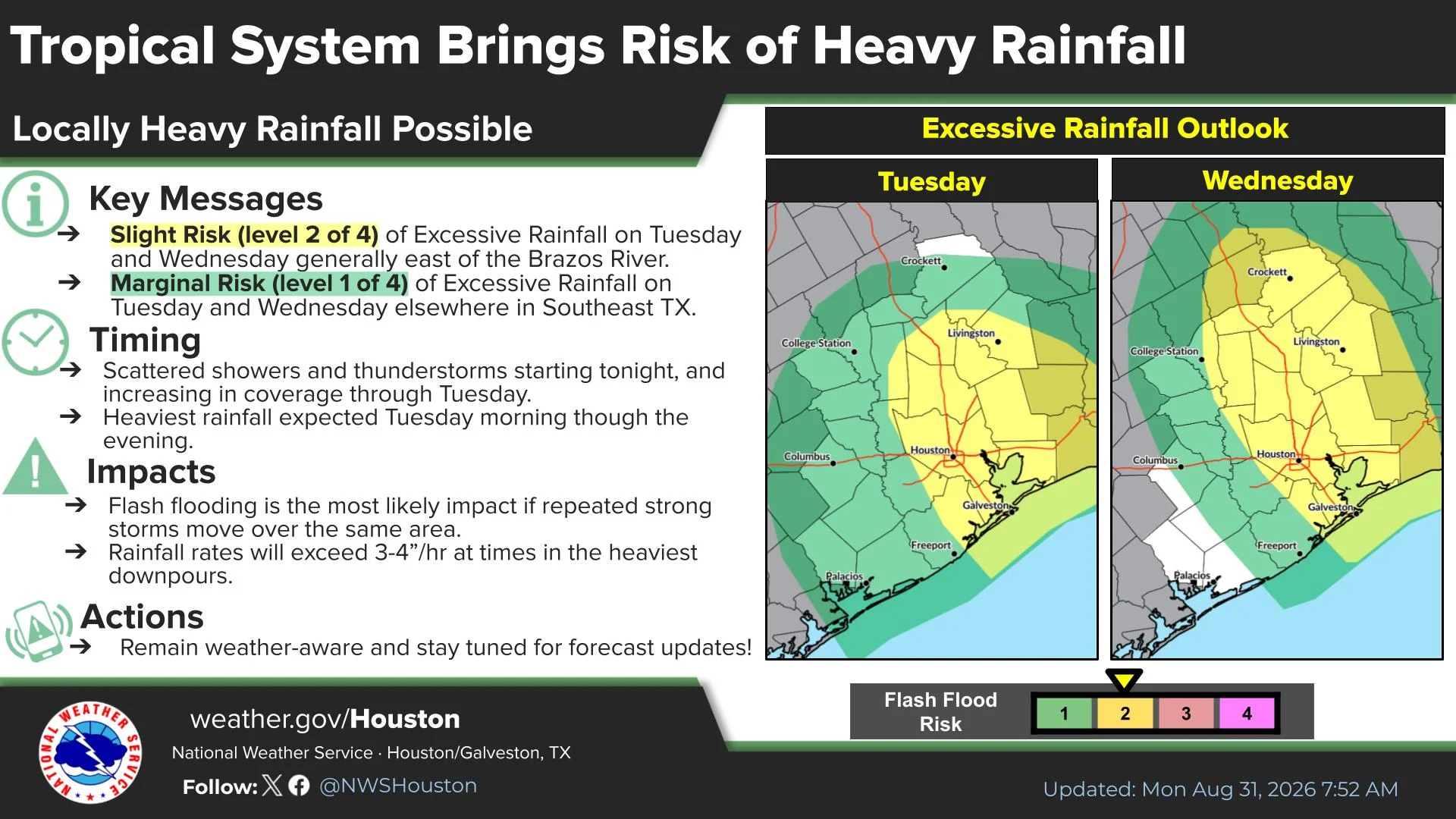
Rainfall rates could reach 3 to 4 inches per hour in the strongest downpours. Repeated storms over the same area could result in flash flooding, including water covering streets and other low-lying areas.
What are the primary concerns?
Heavy rainfall and localized flooding are expected to be the primary threats in Walker County. Gusty winds are also possible, but tropical-storm-force winds are not currently forecast for the county.
Walker County is not under a Tropical Storm Warning as of Monday afternoon. A warning is in effect for portions of the upper Texas and southwestern Louisiana coast, including the area from Port Bolivar, Texas, to the Vermilion and Cameron Parish line in Louisiana.
Residents should monitor changing forecasts, avoid driving through flooded roadways and make sure weather alerts are enabled on their phones. The storm’s track, rainfall totals and local impacts could change as the system develops.
Official updates are available from the National Weather Service Houston/Galveston office and the National Hurricane Center.
Hello Huntsville will continue updating this page as new information becomes available.